See more: Chinese

Chinese Land & Water 1: 3-Part Reading
$19.95 USD
中国土地与水1:3部分阅读
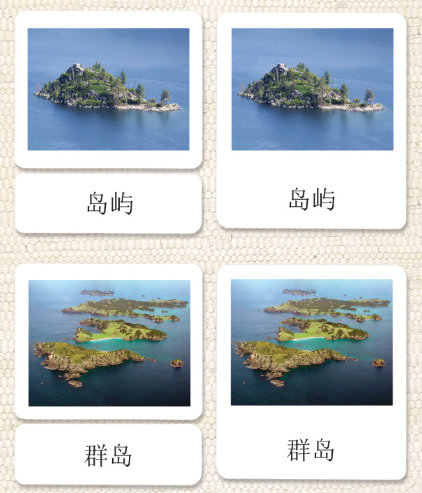
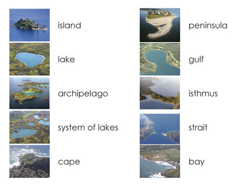
现在您可以用真实的地点,用完美的中文清晰地描绘出岛屿、湖泊、群岛、湖系、海角、海湾、半岛、海湾、地峡、海峡10个基本的水陆地理形态。与中国AMI培训中心共同开发。
Now you can use real locations to clearly depict the 10 basic land and water geographic formations of island, lake, archipelago, system of lakes, cape, bay, peninsula, gulf, isthmus, and strait in perfect Chinese.
- 3-part format includes photos, labels, and control cards (word and label put together)
- 10 geographic formations that match the land & water trays; 30 cards total
- Rounded corners (no pricked fingers or dog-eared cards)
- Comes in a sturdy, clear reclosable bag for storage
- Lesson plan included
Created by a Montessori teacher and eco-printed by parents/teachers/students in our rural New England office. Cloth pouches sold separately.
Also available in Spanish and English. Developed with the AMI Training Center of China. Approximate card sizes are 3¾” x 4¼” (control cards), 3¾“ x 3” (photo cards), and 3¾” x 1¼” (word cards).
Made in the USA.
Item #: CHLAND1
Share:

