
Geography: Series 3
$14.95 USD
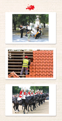
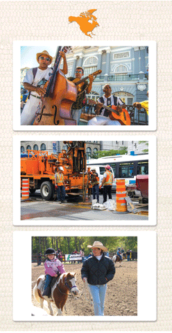
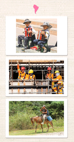
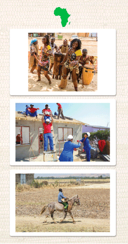
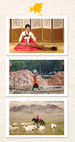
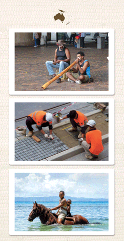
Series Three continues on the foundation built in Series One and Series Two. Series Three includes 10 parallel images for each continent with permanent residents (10 cards/packet; 60 images in the series, Antarctica is excluded). These photographs broadly represent life, landscape, and culture on Earth:
- Playing music
- A construction scene
- Riding a horse
- A city at night
- A favorite food
- Riding a bike
- A train
- Working with animals
- Snow sport
- Boating
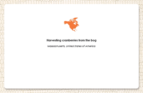
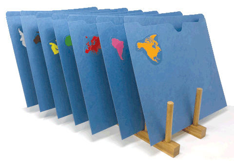
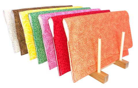
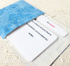
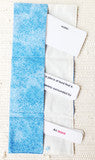
The back of each card contains an image of the continent (color-coded to match the Montessori continent map), the location where the photo was taken, and additional information when needed. Cards are approx. 8 1/2" x 5 1/2”, fully laminated (with our sturdy, clinically-studied, non-toxic/food-grade laminate), and have rounded corners.
Note: All of our geography cards are fully laminated, ready to use, and meet or exceed CPSIA standards.
Use our collections (Series 1, Series 2, and Series 3) as a foundation but don't stop there. Encourage the children to use magazines, calendars and the internet to create more scenes from around the world based on their interests (but always be sure to present parallel images from all continents).
Parallel Images: To create an equitable and balanced view of life around the world, each continent folder within a series contains one image for 10 clearly defined concepts/themes (see bullet points above). This allows children to compare and contrast clothing, food, transportation, etc. from continent to continent. Because balance is not always possible for Antarctica, that continent is intentionally excluded from Series 3.
Many Activities: These inspiring photos rouse the children's natural curiosity and, thus, effortlessly aid the development of expressive and receptive vocabulary. They also create limitless possibilities for meaningful work. Begin by gathering one or a few children, choosing a folder (beginning with the children's home continent), and talking about what everyone sees in each image.
Later, you can use the photos for sorting games by asking which card is from which continent? (Continent pieces not included; we recommend using the pieces from the continent puzzle map.) Then, when the children are writing (with the movable alphabet, chalkboards, or a pencil), use these to inspire the recording process. For example, you can teach the children how to play detective by having one child write about their favorite image and then, later, have another child read it and find the image described. The possibilities are endless!
Created by a Montessori teacher with explicit guidance from AMI teacher trainers. Eco-printed in our rural New England office. Display folders or Cloth Pouches sold separately.
Made in the USA.
NOTE: Geographers carry on a lively debate about what it is that defines a continent. Some consider Australia as a part of the larger continent of Oceania (which includes Micronesia, Polynesia, etc.) while others consider Australia the primary continent that includes the oceanic islands. For our purposes, we use the term Australia to include Australia, New Zealand, Tanzania, the entire island of New Guinea, and the thousands of islands in the Central and South Pacific that make up Melanesia, Micronesia, and Polynesia.
Item #s:
- Complete Series 3 Set/6: GF3ALL
- Africa Series 3: GF3AFRICA
- Asia Series 3: GF3ASIA
- Australia Series 3: GF3AUSTR
- Europe Series 3: GF3EUROP
- North America Series 3: GF3NAMER
- South America Series 3: GF3SAMER
- Blue Folder Set/7: GFOLDSET/7
- Cloth Pouch Set/7: P1XSET/7
