Imperfect Chinese Land & Water 1: 3-Part Reading
 Rooted in Neurodevelopment
-

See the Guided Lesson Plan
 High quality materials
 Eco-Happy
 Fun & Engaging Activities
Ages/Stages
Common Core
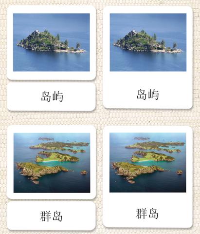
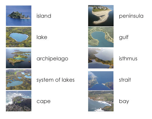
Scratch & Dent Discount: Now you can use real locations to clearly depict the 10 basic land and water geographic formations of island, lake, archipelago, system of lakes, cape, bay, peninsula, gulf, isthmus, and strait in perfect Chinese.
Item #: DISCH3LAND1
Product Details
Imperfect Chinese Land & Water 1: 3-Part Reading
Sale price$13.95 USD
Regular price$19.95 USD
Choose options
Imperfect Chinese Land & Water 1: 3-Part Reading
Sale price$13.95 USD
Regular price$19.95 USD
Download a PDF of our materials

Follow Us